
Beaumont-Hague topographic map
Interactive map
Click on the map to display elevation.
About this map
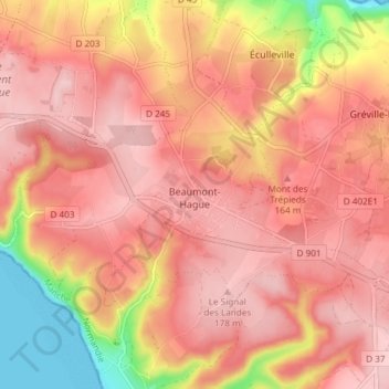
Name: Beaumont-Hague topographic map, elevation, terrain.
Average elevation: 119 m
Minimum elevation: 0 m
Maximum elevation: 189 m
Other topographic maps
Click on a map to view its topography, its elevation and its terrain.
Éculleville
Éculleville, La Hague, Cherbourg, Manche, Normandie, France métropolitaine, 50440, France
Average elevation: 95 m