
Hassan topographic map
Interactive map
Click on the map to display elevation.
About this map
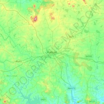
Name: Hassan topographic map, elevation, terrain.
Location: Hassan, Hasana taluk, Hassan District, Karnataka, 573201, Inde (12.84708 75.93927 13.16708 76.25927)
Average elevation: 949 m
Minimum elevation: 847 m
Maximum elevation: 1,275 m