
Bordighera topographic map
Interactive map
Click on the map to display elevation.
About this map
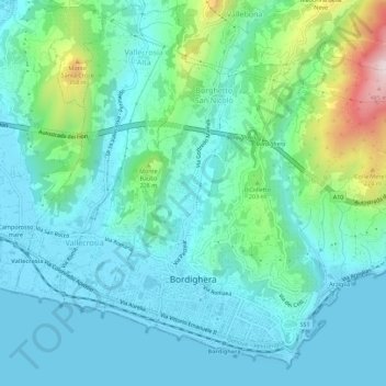
Name: Bordighera topographic map, elevation, terrain.
Location: Bordighera, IM, Ligurien, 18012, Italien (43.77569 7.64626 43.81229 7.70198)
Average elevation: 102 m
Minimum elevation: -1 m
Maximum elevation: 509 m