Phoenix topographic map
Click on the map to display elevation.
Phoenix
Phoenix is in the south-central portion of Arizona; about halfway between Tucson to the southeast and Flagstaff to the north, in the southwestern United States. By car, the city is approximately 150 miles (240 kilometers) north of the US–Mexico border at Sonoyta and 180 mi (290 km) north of the border at Nogales. The metropolitan area is known as the "Valley of the Sun" due to its location in the Salt River Valley. It lies at a mean elevation of 1,086 feet (331 m), in the northern reaches of the Sonoran Desert.
About this map
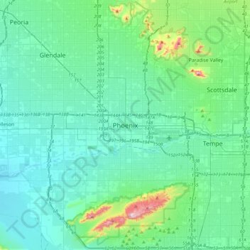
Name: Phoenix topographic map, elevation, terrain.
Average elevation: 368 m
Minimum elevation: 292 m
Maximum elevation: 813 m
Other topographic maps
Click on a map to view its topography, its elevation and its terrain.


Rio Salado Audubon Center
United States > Arizona > Maricopa County > Phoenix
Average elevation: 328 m

Papago Park
United States > Arizona > Maricopa County > Phoenix
The Ponds have a surface area of 6 acres (2.4 ha) with an average depth of 8 ft (2.4 m), the elevation of the area is 1,100 ft (340 m).
Average elevation: 383 m