
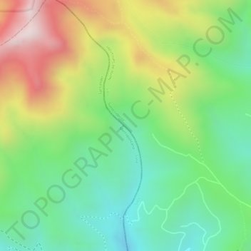
Paramo de Santurbán topographic map
Interactive map
Click on the map to display elevation.
About this map
Name: Paramo de Santurbán topographic map, elevation, terrain.
Average elevation: 3,669 m
Minimum elevation: 3,443 m
Maximum elevation: 3,987 m
Other topographic maps
Click on a map to view its topography, its elevation and its terrain.
Río Cáraba
Colombia > Norte de Santander > Silos
Río Cáraba, Silos, Suroccidente, Norte de Santander, RAP Gran Santander, Colombia
Average elevation: 3,391 m