
Thank you for supporting this site ❤️
Make a donation
Make a donation
Ghlin topographic map
Click on the map to display elevation.
Thank you for supporting this site ❤️
Make a donation
Make a donation
About this map
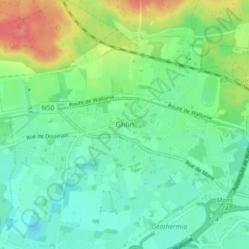
Name: Ghlin topographic map, elevation, terrain.
Location: Ghlin, Mons, Hainaut, Wallonie, 7011, Belgique (50.45605 3.88375 50.49605 3.92375)
Average elevation: 39 m
Minimum elevation: 17 m
Maximum elevation: 90 m
Thank you for supporting this site ❤️
Make a donation
Make a donation
Other topographic maps
Click on a map to view its topography, its elevation and its terrain.