
Ticalan topographic map
Click on the map to display elevation.
About this map
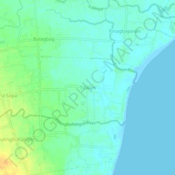
Name: Ticalan topographic map, elevation, terrain.
Location: Ticalan, San Juan, Batangas, Calabarzon, Philippines (13.77220 121.40824 13.81220 121.44824)
Average elevation: 8 m
Minimum elevation: -1 m
Maximum elevation: 30 m