
Thank you for supporting this site ❤️
Make a donation
Make a donation
Harrison Township topographic map
Click on the map to display elevation.
Thank you for supporting this site ❤️
Make a donation
Make a donation
About this map
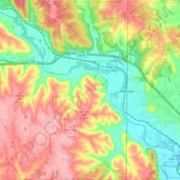
Name: Harrison Township topographic map, elevation, terrain.
Location: Harrison Township, Dearborn County, Indiana, United States (39.21868 -84.91114 39.30632 -84.81933)
Average elevation: 217 m
Minimum elevation: 146 m
Maximum elevation: 291 m
Thank you for supporting this site ❤️
Make a donation
Make a donation
Other topographic maps
Click on a map to view its topography, its elevation and its terrain.