Geolocate

Wahlkreis Toggenburg topographic map

Interactive map

Click on the map to display elevation.

About this map

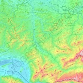
Name: Wahlkreis Toggenburg topographic map, elevation, terrain.

Location: Wahlkreis Toggenburg, St. Gallen, Switzerland (47.14472 8.94352 47.44423 9.40198)

Average elevation: 900 m

Minimum elevation: 401 m

Maximum elevation: 2,479 m

Other topographic maps

Click on a map to view its topography, its elevation and its terrain.

Alt St. Johann

Switzerland > St. Gallen > Wahlkreis Toggenburg > Wildhaus-Alt St. Johann

Alt St. Johann, Wildhaus-Alt St. Johann, Wahlkreis Toggenburg, St. Gallen, Switzerland

Average elevation: 1,429 m

Wildhaus-Alt St. Johann

Switzerland > St. Gallen > Wahlkreis Toggenburg

Wildhaus-Alt St. Johann, Wahlkreis Toggenburg, St. Gallen, Switzerland

Average elevation: 1,453 m