
Thank you for supporting this site ❤️
Make a donation
Make a donation
San Carlos topographic map
Click on the map to display elevation.
Thank you for supporting this site ❤️
Make a donation
Make a donation
About this map
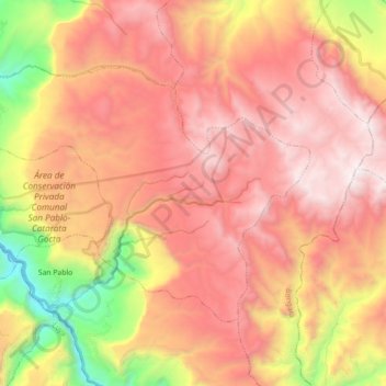
Name: San Carlos topographic map, elevation, terrain.
Location: San Carlos, Provincia de Bongará, Amazonas, Perú (-6.06547 -77.97982 -5.94731 -77.80121)
Average elevation: 2,624 m
Minimum elevation: 1,391 m
Maximum elevation: 3,476 m
Thank you for supporting this site ❤️
Make a donation
Make a donation
Other topographic maps
Click on a map to view its topography, its elevation and its terrain.