
Thank you for supporting this site ❤️
Make a donation
Make a donation
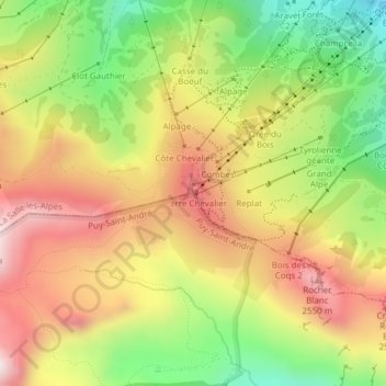
Serre Chevalier topographic map
Click on the map to display elevation.
Thank you for supporting this site ❤️
Make a donation
Make a donation
Serre Chevalier
The maximum elevation for skiing is at Telesiege Yret at 2,800 m (9,190 ft) above sea level, and the minimum is 1,200 m (3,940 ft), a total vertical drop of 1,600 m (5,250 ft). One of the outstanding features of Serre Chevalier is the wooded nature of the slopes. The timber line is at 2,150 m (7,050 ft), yielding about 700 m (2,300 ft) of vertical drop of tree-lined slopes.
Thank you for supporting this site ❤️
Make a donation
Make a donation
About this map
Name: Serre Chevalier topographic map, elevation, terrain.
Average elevation: 2,256 m
Minimum elevation: 1,905 m
Maximum elevation: 2,592 m
Thank you for supporting this site ❤️
Make a donation
Make a donation