
Metz topographic map
Interactive map
Click on the map to display elevation.
About this map
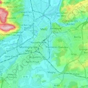
Name: Metz topographic map, elevation, terrain.
Location: Metz, Moselle, Grand Est, France métropolitaine, France (49.06082 6.13600 49.14880 6.25645)
Average elevation: 196 m
Minimum elevation: 160 m
Maximum elevation: 358 m
Other topographic maps
Click on a map to view its topography, its elevation and its terrain.