
Lawrence Road topographic map
Interactive map
Click on the map to display elevation.
About this map
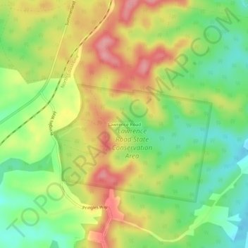
Name: Lawrence Road topographic map, elevation, terrain.
Location: Lawrence Road, Grafton, Clarence Valley Council, Australia (-29.41833 152.99778 -29.37833 153.03778)
Average elevation: 72 m
Minimum elevation: 18 m
Maximum elevation: 131 m