
Inangahua topographic map
Interactive map
Click on the map to display elevation.
About this map
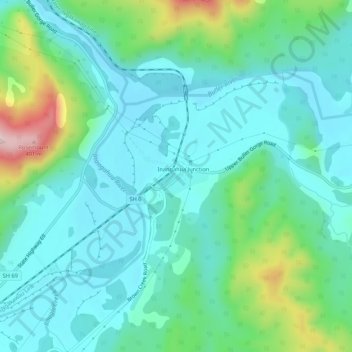
Name: Inangahua topographic map, elevation, terrain.
Location: Inangahua, Buller District, West Coast, New Zealand (-41.87744 171.93141 -41.83744 171.97141)
Average elevation: 119 m
Minimum elevation: 40 m
Maximum elevation: 397 m