
Nyabisindu topographic map
Interactive map
Click on the map to display elevation.
About this map
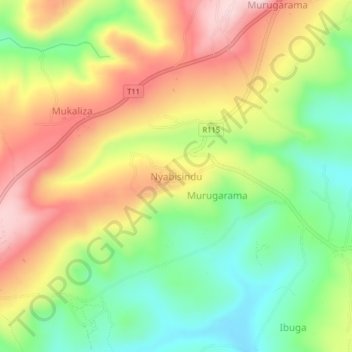
Name: Nyabisindu topographic map, elevation, terrain.
Location: Nyabisindu, Ngara, Kagera, Lake Zone, Tanzania (-2.63845 30.48362 -2.59845 30.52362)
Average elevation: 1,488 m
Minimum elevation: 1,355 m
Maximum elevation: 1,638 m