
Cerro Taguaza topographic map
Interactive map
Click on the map to display elevation.
About this map
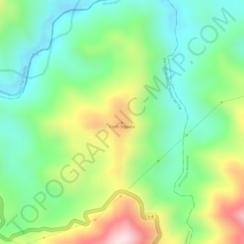
Name: Cerro Taguaza topographic map, elevation, terrain.
Average elevation: 210 m
Minimum elevation: 68 m
Maximum elevation: 440 m
Other topographic maps
Click on a map to view its topography, its elevation and its terrain.
Santa Teresa del Tuy
Venezuela > Estado Miranda > Municipio Independencia > Santa Teresa del Tuy
Santa Teresa del Tuy, Parroquia Santa Teresa del Tuy, Municipio Independencia, Estado Miranda, 1215, Venezuela
Average elevation: 396 m