
Hauraki District topographic map
Interactive map
Click on the map to display elevation.
About this map
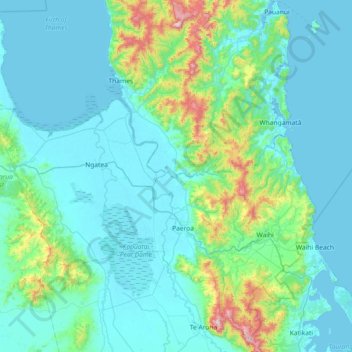
Name: Hauraki District topographic map, elevation, terrain.
Location: Hauraki District, Waikato, New Zealand (-37.56394 175.21715 -37.02404 175.94409)
Average elevation: 108 m
Minimum elevation: -2 m
Maximum elevation: 899 m
Other topographic maps
Click on a map to view its topography, its elevation and its terrain.
Te Moananui
New Zealand > Waikato > Hauraki District
Te Moananui, Hauraki District, Waikato, 3600, New Zealand
Average elevation: 28 m