
Mansfeld topographic map
Interactive map
Click on the map to display elevation.
About this map
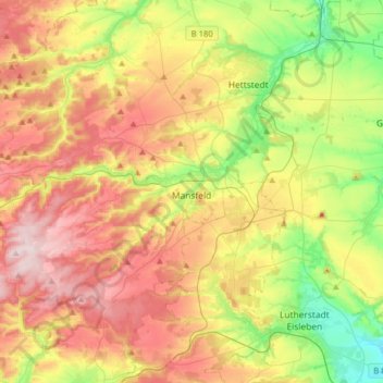
Name: Mansfeld topographic map, elevation, terrain.
Location: Mansfeld, Mansfeld-Südharz, Saksen-Anhalt, Duitsland (51.52793 11.19806 51.66171 11.51536)
Average elevation: 242 m
Minimum elevation: 97 m
Maximum elevation: 406 m