
Eigenthal topographic map
Interactive map
Click on the map to display elevation.
About this map
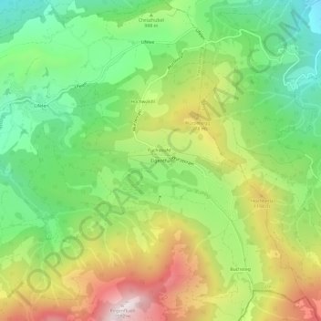
Name: Eigenthal topographic map, elevation, terrain.
Location: Eigenthal, Schwarzenberg, Lucerne, 6013, Suisse (46.98883 8.19122 47.02883 8.23122)
Average elevation: 991 m
Minimum elevation: 603 m
Maximum elevation: 1,548 m