
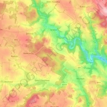
Strážek topographic map
Interactive map
Click on the map to display elevation.
About this map
Name: Strážek topographic map, elevation, terrain.
Average elevation: 506 m
Minimum elevation: 391 m
Maximum elevation: 601 m
Strážek befindet sich im Tal der Bobrůvka in der Böhmisch-Mährischen Höhe. Südlich erhebt sich die Strážnice (Straschkauer Berg, 550 m) und im Nordwesten die Baršovice (543 m).