
Jecheon-si topographic map
Interactive map
Click on the map to display elevation.
About this map
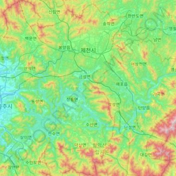
Name: Jecheon-si topographic map, elevation, terrain.
Location: Jecheon-si, Chungcheongbuk-do, South Korea (36.81296 127.92121 37.25849 128.33440)
Average elevation: 381 m
Minimum elevation: 65 m
Maximum elevation: 1,387 m