
Thank you for supporting this site ❤️
Make a donation
Make a donation
Hatillo topographic map
Click on the map to display elevation.
Thank you for supporting this site ❤️
Make a donation
Make a donation
About this map
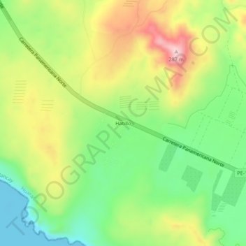
Name: Hatillo topographic map, elevation, terrain.
Location: Hatillo, Chancay, Huaral, Lima, Perú (-11.46811 -77.36451 -11.42811 -77.32451)
Average elevation: 130 m
Minimum elevation: -1 m
Maximum elevation: 306 m
Thank you for supporting this site ❤️
Make a donation
Make a donation
Other topographic maps
Click on a map to view its topography, its elevation and its terrain.