
Thank you for supporting this site ❤️
Make a donation
Make a donation
Puerto Colombia topographic map
Click on the map to display elevation.
Thank you for supporting this site ❤️
Make a donation
Make a donation
About this map
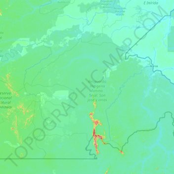
Name: Puerto Colombia topographic map, elevation, terrain.
Location: Puerto Colombia, Guainía, RAP Amazonía, Colombia (1.81155 -69.18637 3.17925 -67.33469)
Average elevation: 129 m
Minimum elevation: 80 m
Maximum elevation: 919 m
Thank you for supporting this site ❤️
Make a donation
Make a donation
Other topographic maps
Click on a map to view its topography, its elevation and its terrain.