
Risca topographic map
Interactive map
Click on the map to display elevation.
About this map
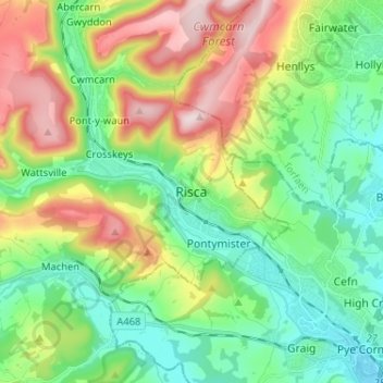
Name: Risca topographic map, elevation, terrain.
Location: Risca, Caerphilly, Gales, NP11, Reino Unido (51.57195 -3.13648 51.65195 -3.05648)
Average elevation: 153 m
Minimum elevation: 17 m
Maximum elevation: 417 m