
Thank you for supporting this site ❤️
Make a donation
Make a donation
Mpanda Municipal topographic map
Click on the map to display elevation.
Thank you for supporting this site ❤️
Make a donation
Make a donation
About this map
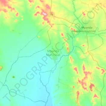
Name: Mpanda Municipal topographic map, elevation, terrain.
Location: Mpanda Municipal, Katavi Region, Western Zone, 50102, Tanzania (-6.54486 30.84741 -6.27761 31.13190)
Average elevation: 1,065 m
Minimum elevation: 975 m
Maximum elevation: 1,375 m
Thank you for supporting this site ❤️
Make a donation
Make a donation
Other topographic maps
Click on a map to view its topography, its elevation and its terrain.