
Thank you for supporting this site ❤️
Make a donation
Make a donation
Tanot topographic map
Click on the map to display elevation.
Thank you for supporting this site ❤️
Make a donation
Make a donation
About this map
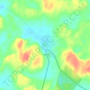
Name: Tanot topographic map, elevation, terrain.
Location: Tanot, Jaisalmer Tehsil, Jaisalmer District, Rajasthan, India (27.77601 70.33316 27.81601 70.37316)
Average elevation: 107 m
Minimum elevation: 84 m
Maximum elevation: 139 m
Thank you for supporting this site ❤️
Make a donation
Make a donation
Other topographic maps
Click on a map to view its topography, its elevation and its terrain.