
Kleindorog topographic map
Interactive map
Click on the map to display elevation.
About this map
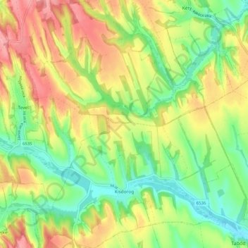
Name: Kleindorog topographic map, elevation, terrain.
Average elevation: 157 m
Minimum elevation: 101 m
Maximum elevation: 227 m
Other topographic maps
Click on a map to view its topography, its elevation and its terrain.
Tolnau
Tolnau, Tolnai járás, Komitat Tolnau, Südtransdanubien, Transdanubien, Ungarn
Average elevation: 97 m