
Thank you for supporting this site ❤️
Make a donation
Make a donation
Wertheim topographic map
Click on the map to display elevation.
Thank you for supporting this site ❤️
Make a donation
Make a donation
About this map
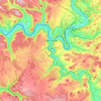
Name: Wertheim topographic map, elevation, terrain.
Location: Wertheim, Main-Tauber-Kreis, Baden-Württemberg, 97877, Germany (49.69270 9.36774 49.79129 9.65199)
Average elevation: 283 m
Minimum elevation: 127 m
Maximum elevation: 460 m
Thank you for supporting this site ❤️
Make a donation
Make a donation
Other topographic maps
Click on a map to view its topography, its elevation and its terrain.