
Thank you for supporting this site ❤️
Make a donation
Make a donation
Pont de l'Olive topographic map
Click on the map to display elevation.
Thank you for supporting this site ❤️
Make a donation
Make a donation
About this map
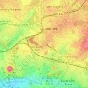
Name: Pont de l'Olive topographic map, elevation, terrain.
Location: Pont de l'Olive, La Louvière, Hainaut, Wallonie, 7100, Belgique (50.45228 4.16222 50.49228 4.20222)
Average elevation: 112 m
Minimum elevation: 53 m
Maximum elevation: 168 m
Thank you for supporting this site ❤️
Make a donation
Make a donation