
Riegel topographic map
Interactive map
Click on the map to display elevation.
About this map
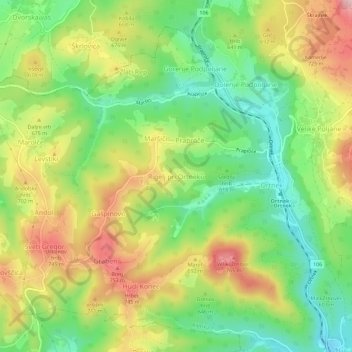
Name: Riegel topographic map, elevation, terrain.
Location: Riegel, Ribnica, 1316, Slowenien (45.77229 14.64312 45.81229 14.68312)
Average elevation: 635 m
Minimum elevation: 516 m
Maximum elevation: 789 m