
Thank you for supporting this site ❤️
Make a donation
Make a donation
Winfield Township topographic map
Click on the map to display elevation.
Thank you for supporting this site ❤️
Make a donation
Make a donation
About this map
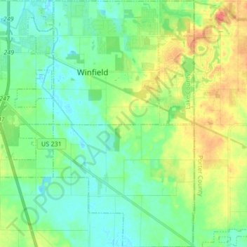
Name: Winfield Township topographic map, elevation, terrain.
Location: Winfield Township, Lake County, Indiana, United States (41.33307 -87.29707 41.43477 -87.21949)
Average elevation: 220 m
Minimum elevation: 204 m
Maximum elevation: 251 m
Thank you for supporting this site ❤️
Make a donation
Make a donation
Other topographic maps
Click on a map to view its topography, its elevation and its terrain.