
Thank you for supporting this site ❤️
Make a donation
Make a donation
Tourais topographic map
Click on the map to display elevation.
Thank you for supporting this site ❤️
Make a donation
Make a donation
About this map
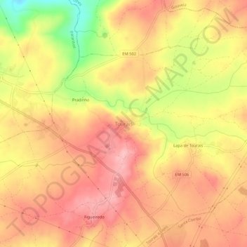
Name: Tourais topographic map, elevation, terrain.
Location: Tourais, Seia, Guarda, 6270-584, Portugal (40.45136 -7.77078 40.49136 -7.73078)
Average elevation: 428 m
Minimum elevation: 335 m
Maximum elevation: 478 m
Thank you for supporting this site ❤️
Make a donation
Make a donation