
Palacio topographic map
Click on the map to display elevation.
About this map
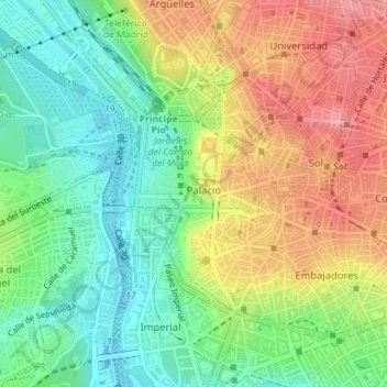
Name: Palacio topographic map, elevation, terrain.
Location: Palacio, Centro, Madrid, Community of Madrid, Spain (40.40669 -3.72291 40.42339 -3.70610)
Average elevation: 626 m
Minimum elevation: 577 m
Maximum elevation: 687 m
Other topographic maps
Click on a map to view its topography, its elevation and its terrain.