
Thank you for supporting this site ❤️
Make a donation
Make a donation
Desa Cijulang topographic map
Click on the map to display elevation.
Thank you for supporting this site ❤️
Make a donation
Make a donation
About this map
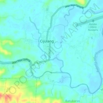
Name: Desa Cijulang topographic map, elevation, terrain.
Location: Desa Cijulang, Pangandaran, Java, 46394, Indonesia (-7.74610 108.45710 -7.71606 108.49380)
Average elevation: 11 m
Minimum elevation: 0 m
Maximum elevation: 59 m
Thank you for supporting this site ❤️
Make a donation
Make a donation
Other topographic maps
Click on a map to view its topography, its elevation and its terrain.