
Thank you for supporting this site ❤️
Make a donation
Make a donation
Mekarwangi topographic map
Click on the map to display elevation.
Thank you for supporting this site ❤️
Make a donation
Make a donation
About this map
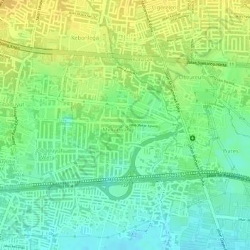
Name: Mekarwangi topographic map, elevation, terrain.
Average elevation: 678 m
Minimum elevation: 663 m
Maximum elevation: 692 m
Thank you for supporting this site ❤️
Make a donation
Make a donation
Other topographic maps
Click on a map to view its topography, its elevation and its terrain.
Non Block High Level Conference Monument Park
Indonesia > West Java > Bandung City > Arjuna
Average elevation: 731 m
Thank you for supporting this site ❤️
Make a donation
Make a donation