
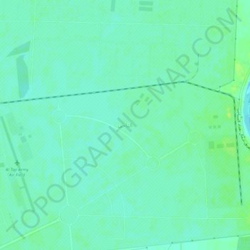
At Taji topographic map
Interactive map
Click on the map to display elevation.
About this map
Name: At Taji topographic map, elevation, terrain.
Average elevation: 38 m
Minimum elevation: 32 m
Maximum elevation: 46 m
Other topographic maps
Click on a map to view its topography, its elevation and its terrain.
Nile
Iraq > Baghdad Governorate > Baghdad
Nile, Palestine Subdistrict, Al-Rusafa District, Baghdad, Al-Rusafa Municipality, Baghdad Governorate, 10045, Iraq
Average elevation: 37 m
Al-Adhamiyah District
Iraq > Baghdad Governorate > Baghdad
Al-Adhamiyah District, Baghdad, Al-Sha'ab Municipality, Baghdad Governorate, Iraq
Average elevation: 38 m
Al Rasheed Camp
Iraq > Baghdad Governorate > Baghdad
Al Rasheed Camp, Zaefarania Subdistrict, Al-Rusafa District, Baghdad, Baghdad Governorate, Iraq
Average elevation: 36 m
Al-Karkh District
Iraq > Baghdad Governorate > Baghdad
Al-Karkh District, Baghdad, Al-Rashid Municipality, Baghdad Governorate, Iraq
Average elevation: 36 m
Al-Sha'ab Municipality
Iraq > Baghdad Governorate > Baghdad City
Al-Sha'ab Municipality, Al-Fahamah Subdistrict, Al-Adhamiyah District, Baghdad City, Baghdad Governorate, Iraq
Average elevation: 37 m
Al-Karrada Municipality
Iraq > Baghdad Governorate > Baghdad City
Al-Karrada Municipality, Zafriniya, Al-Karrada Subdistrict, Al-Rusafa District, Baghdad City, Baghdad Governorate, Iraq
Average elevation: 36 m
Baghdad
Baghdad, Green Zone Municipality, Baghdad Governorate, Iraq
Average elevation: 36 m
Al-Kadhimiya Municipality
Iraq > Baghdad Governorate > Baghdad
Al-Kadhimiya Municipality, Baghdad, Al-Kadhimiya Central Subdistrict, Al-Kadhimiya District, Baghdad Governorate, Iraq
Average elevation: 37 m
Al-Rashid Municipality
Iraq > Baghdad Governorate > Baghdad
Al-Rashid Municipality, Baghdad, Al-Ma'mun Subdistrict, Al-Karkh District, Baghdad Governorate, Iraq
Average elevation: 35 m