
Thank you for supporting this site ❤️
Make a donation
Make a donation
Pupukea topographic map
Click on the map to display elevation.
Thank you for supporting this site ❤️
Make a donation
Make a donation
About this map
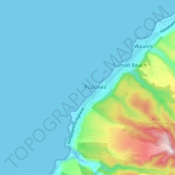
Name: Pupukea topographic map, elevation, terrain.
Location: Pupukea, Waiale‘e, Honolulu County, Hawaii, United States (21.63292 -158.07695 21.69487 -158.01832)
Average elevation: 51 m
Minimum elevation: 0 m
Maximum elevation: 308 m
Thank you for supporting this site ❤️
Make a donation
Make a donation