
Thank you for supporting this site ❤️
Make a donation
Make a donation
Bauzenbach topographic map
Click on the map to display elevation.
Thank you for supporting this site ❤️
Make a donation
Make a donation
About this map
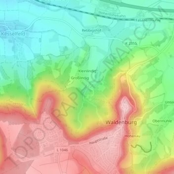
Name: Bauzenbach topographic map, elevation, terrain.
Average elevation: 402 m
Minimum elevation: 313 m
Maximum elevation: 509 m
Thank you for supporting this site ❤️
Make a donation
Make a donation
Other topographic maps
Click on a map to view its topography, its elevation and its terrain.
Domäne Hohebuch
Deutschland > Baden-Württemberg > Hohenlohekreis > Waldenburg
Average elevation: 357 m
Gewerbepark Hohenlohe
Deutschland > Baden-Württemberg > Hohenlohekreis > Waldenburg
Average elevation: 359 m
Thank you for supporting this site ❤️
Make a donation
Make a donation