
Тургояк topographic map
Interactive map
Click on the map to display elevation.
About this map
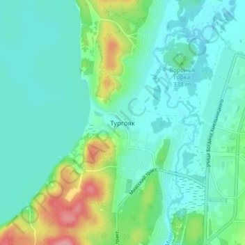
Name: Тургояк topographic map, elevation, terrain.
Average elevation: 333 m
Minimum elevation: 306 m
Maximum elevation: 424 m
Other topographic maps
Click on a map to view its topography, its elevation and its terrain.
Miass
Russie > Oblast de Tcheliabinsk > Миасский городской округ
Miass, Миасский городской округ, Oblast de Tcheliabinsk, District fédéral de l'Oural, Russie
Average elevation: 389 m