
Great Meadows topographic map
Interactive map
Click on the map to display elevation.
About this map
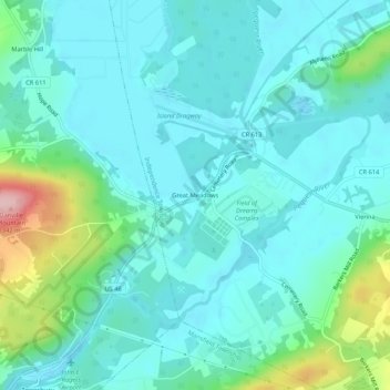
Name: Great Meadows topographic map, elevation, terrain.
Location: Great Meadows, Warren County, New Jersey, 07838, USA (40.85093 -74.93211 40.89093 -74.89211)
Average elevation: 185 m
Minimum elevation: 146 m
Maximum elevation: 349 m