
Cheyenne topographic map
Interactive map
Click on the map to display elevation.
About this map
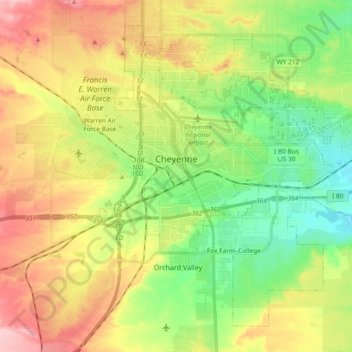
Name: Cheyenne topographic map, elevation, terrain.
Location: Cheyenne, Laramie County, Wyoming, USA (41.07310 -104.86112 41.19303 -104.67493)
Average elevation: 1,871 m
Minimum elevation: 1,803 m
Maximum elevation: 1,962 m