Glacier des Follâts topographic map
Interactive map
Click on the map to display elevation.
About this map
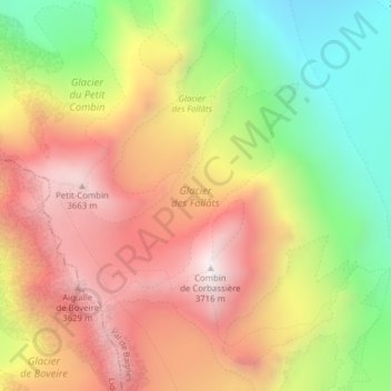
Name: Glacier des Follâts topographic map, elevation, terrain.
Average elevation: 3,149 m
Minimum elevation: 2,535 m
Maximum elevation: 3,706 m

Click on the map to display elevation.
Name: Glacier des Follâts topographic map, elevation, terrain.
Average elevation: 3,149 m
Minimum elevation: 2,535 m
Maximum elevation: 3,706 m