
Thank you for supporting this site ❤️
Make a donation
Make a donation
Merl topographic map
Click on the map to display elevation.
Thank you for supporting this site ❤️
Make a donation
Make a donation
About this map
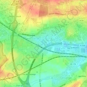
Name: Merl topographic map, elevation, terrain.
Location: Merl, Luxembourg, Canton Luxembourg, Luxembourg (49.58769 6.06929 49.61334 6.10821)
Average elevation: 288 m
Minimum elevation: 264 m
Maximum elevation: 317 m
Thank you for supporting this site ❤️
Make a donation
Make a donation