
Thank you for supporting this site ❤️
Make a donation
Make a donation
Los Angeles topographic map
Click on the map to display elevation.
Thank you for supporting this site ❤️
Make a donation
Make a donation
About this map
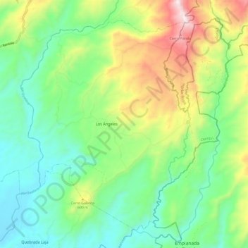
Name: Los Angeles topographic map, elevation, terrain.
Location: Los Angeles, Distrito Gualaca, Chiriquí, Panamá (8.47373 -82.24415 8.57443 -82.12483)
Average elevation: 337 m
Minimum elevation: 60 m
Maximum elevation: 907 m
Thank you for supporting this site ❤️
Make a donation
Make a donation
Other topographic maps
Click on a map to view its topography, its elevation and its terrain.