
Thank you for supporting this site ❤️
Make a donation
Make a donation
Redwood Valley topographic map
Click on the map to display elevation.
Thank you for supporting this site ❤️
Make a donation
Make a donation
About this map
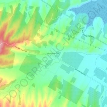
Name: Redwood Valley topographic map, elevation, terrain.
Location: Redwood Valley, Tasman, 7081, New Zealand (-41.32159 173.05812 -41.28159 173.09812)
Average elevation: 46 m
Minimum elevation: 0 m
Maximum elevation: 144 m
Thank you for supporting this site ❤️
Make a donation
Make a donation
Other topographic maps
Click on a map to view its topography, its elevation and its terrain.