
Thank you for supporting this site ❤️
Make a donation
Make a donation
Forest topographic map
Click on the map to display elevation.
Thank you for supporting this site ❤️
Make a donation
Make a donation
About this map
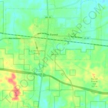
Name: Forest topographic map, elevation, terrain.
Location: Forest, Scott County, Mississippi, United States (32.31335 -89.52165 32.38880 -89.43514)
Average elevation: 145 m
Minimum elevation: 123 m
Maximum elevation: 189 m
Thank you for supporting this site ❤️
Make a donation
Make a donation
Other topographic maps
Click on a map to view its topography, its elevation and its terrain.