
Thank you for supporting this site ❤️
Make a donation
Make a donation
Cody topographic map
Click on the map to display elevation.
Thank you for supporting this site ❤️
Make a donation
Make a donation
Cody
Cody's elevation is approximately 5016 ft (1,500 m) above sea level. The main part of the city is split across three levels, separated by about 60 feet (18 m).
Thank you for supporting this site ❤️
Make a donation
Make a donation
About this map
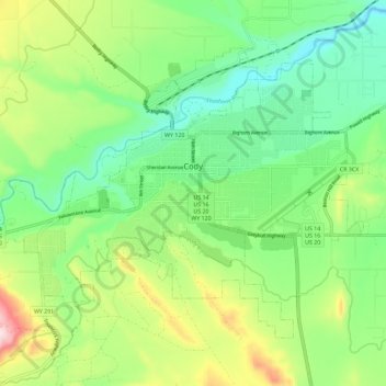
Name: Cody topographic map, elevation, terrain.
Location: Cody, Park County, Wyoming, United States (44.48981 -109.12048 44.55131 -109.00576)
Average elevation: 1,557 m
Minimum elevation: 1,436 m
Maximum elevation: 1,798 m
Thank you for supporting this site ❤️
Make a donation
Make a donation