
Waterloo topographic map
Click on the map to display elevation.
About this map
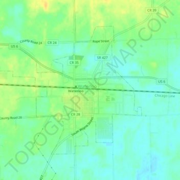
Name: Waterloo topographic map, elevation, terrain.
Location: Waterloo, DeKalb County, Indiana, United States (41.41897 -85.05314 41.44326 -85.00766)
Average elevation: 276 m
Minimum elevation: 266 m
Maximum elevation: 291 m
Other topographic maps
Click on a map to view its topography, its elevation and its terrain.