
Otaru topographic map
Click on the map to display elevation.
Otaru
Otaru is a port town on the coast of the Sea of Japan in northern Shiribeshi Subprefecture. The southern portion of the city is characterized by the steep slopes of various mountains (notably Tenguyama), where the altitude of the land sharply drops from the mountains to the sea. The land available between the coast and mountains has been almost completely developed, and the developed part of the city on the mountain slopes is called Saka-no-machi, or "Hill town", including hills named Funamizaka (Boat-view Hill) and Jigokuzaka (Hell Hill).
About this map
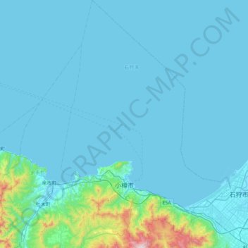
Name: Otaru topographic map, elevation, terrain.
Location: Otaru, Shiribeshi Subprefecture, Hokkaido Prefecture, Japan (43.06084 140.81625 43.56736 141.29254)
Average elevation: 79 m
Minimum elevation: -1 m
Maximum elevation: 1,272 m
Other topographic maps
Click on a map to view its topography, its elevation and its terrain.