
Ténès topographic map
Interactive map
Click on the map to display elevation.
About this map
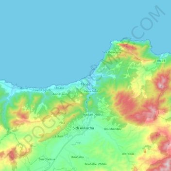
Name: Ténès topographic map, elevation, terrain.
Location: Ténès, Daïra Ténès, Chlef, Algérie (36.45972 1.20703 36.55367 1.41650)
Average elevation: 160 m
Minimum elevation: -1 m
Maximum elevation: 772 m